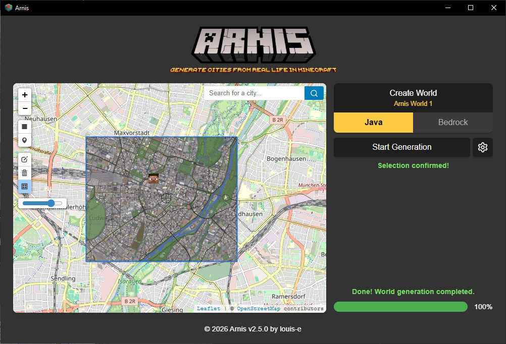
Generate any location from the real world in Minecraft with a high level of detail.
16.7k
Stars
1.4k
Forks
133
Open issues
30
Contributors




AI Analysis
Arnis generates detailed Minecraft Java and Bedrock worlds based on real-world geography, topography, and architecture using OpenStreetMap and elevation data. It is a specialized tool for Minecraft players and enthusiasts who want to recreate specific real-world locations with high fidelity in-game, and does not serve general-purpose mapping or geospatial analysis use cases.
Inferred from signals mentioned in the README (tests, CI, type safety) — not a review of the actual code.
AI's overall editorial judgment — not an average of the bars above, can weigh other factors too.
Arnis converts real-world OpenStreetMap data into detailed Minecraft worlds using Rust
Arnis is an open-source tool that fetches geospatial data from OpenStreetMap and elevation datasets to generate accurate, high-detail Minecraft Java and Bedrock Edition worlds. It targets Minecraft enthusiasts, geography educators, urban planners exploring gamified environments, and hobbyists who want to recreate their hometowns or cities in-game. With 16K+ stars, press coverage from Tom's Hardware, Hackaday, and XDA Developers, an AWS public sector blog feature, and academic citations in education research, it has crossed from hobby project into genuine community and institutional recognition.
Created in September 2022 by louis-e, Arnis grew steadily as a personal Rust project. It gained significant visibility in late December 2024 following a wave of press coverage, pushing it from a niche tool to a widely-shared open source project.
Growth was slow and organic from 2022 to mid-2024, then spiked sharply in December 2024 when coverage from Hackaday, Tom's Hardware, and XDA Developers brought mainstream attention. The star history chart referenced in the README strongly implies this inflection point. Since then, growth has stabilized at a moderate pace (~39 stars/week as of June 2026), consistent with a maturing project with a loyal niche audience.
AWS published a public sector blog post describing Arnis's use of AWS elevation datasets at scale. An academic paper (Floodcraft) cites Arnis for K-12 flood education in Minecraft environments. GitHub release download counters are publicly shown in the README badge. A companion browser-based product (MapSmith) exists, implying some monetization and user demand. These constitute meaningful, verifiable real-world adoption signals beyond casual GitHub traffic.
Likely modular by design: README explicitly lists modularity as a core objective, with distinct components for data fetching, processing, and world generation. Implemented in Rust for performance. Appears to support both a GUI and CLI interface, with optional feature flags (--no-default-features for headless builds). Nix support suggests thoughtful cross-platform packaging.
A CI build badge is present and active, suggesting automated build verification exists. However, test coverage specifics are not documented in the README.
Last push was June 16, 2026 — six days before the evaluation date — indicating active, ongoing maintenance. The project has a Discord server, a dedicated website (arnismc.com), a companion commercial product (MapSmith), and a GitHub Wiki, all suggesting sustained organizational investment. Release cadence and contribution workflow are documented.
ADOPT IF: you want to generate a real-world location in Minecraft with minimal setup and are comfortable with a community-supported open source tool. AVOID IF: you need enterprise-grade reliability, very large map regions without size limitations, or a fully hosted SaaS — consider MapSmith for the latter. MONITOR IF: you are a GIS educator or urban planner evaluating gamified geography tools; Arnis's academic traction and AWS integration suggest growing institutional relevance.
Independent dimensions
Mainstream potential
5/10
Technical importance
7/10
Adoption evidence
7/10
- Dependence on OpenStreetMap data quality means areas with sparse OSM coverage will produce incomplete or inaccurate worlds.
- Elevation dataset availability and access may change, particularly if AWS hosting terms or third-party data sources shift.
- The project appears to be primarily maintained by a single lead developer (louis-e); bus-factor risk exists despite open contribution policy.
- Minecraft's Java/Bedrock API and world format changes between versions could break generation compatibility with future Mojang releases.
- MapSmith as a commercial companion product introduces a potential future tension between open-source scope and paid feature gating.
Arnis is likely to maintain steady growth as a respected niche tool with expanding use in education and GIS communities, and may deepen AWS/cloud integration. Mainstream breakout is unlikely but not the goal.
Newsletter
Get analyses like this every Monday
Free weekly digest of the most interesting open-source discoveries.
Languages
Information
- Website
- https://arnismc.com/
- Language
- Rust
- License
- Apache-2.0
- Last updated
- 18h ago
- Created
- 47mo ago
- Analyzed with
- anthropic/claude-haiku-4-5
Stars over time
Contributors over time
Top 100 contributors only — repos with more will plateau at 100.
Open issues
[FEATURE] Update China Map
Tall Arnis Refuses To Load
[BUG] Buildings in cleveland hidden in other buildings
[FEATURE] Luanti: export for Minetest Game instead of Mineclonia
[BUG] Coastal DEM percision gap leaving artifacts
Top contributors
Similar repos

PistonDevelopers/hematite
Hematite is a Minecraft clone written in Rust using the Piston game engine,...

localgpt-app/localgpt
LocalGPT is a Rust-based application for generating explorable 3D worlds using...

Azgaar/Fantasy-Map-Generator
Fantasy Map Generator is a free web application for creating and editing...
| Repository | Stars | Week Δ | Language | Score | Updated |
|---|---|---|---|---|---|
|
louis-e/arnis
this
|
16.7k | +116 | Rust | 8/10 | 18h ago |
|
PistonDevelopers/hematite
|
1.9k | — | Rust | 6/10 | 2mo ago |
|
localgpt-app/localgpt
|
1.1k | — | Rust | 7/10 | 3w ago |
|
Azgaar/Fantasy-Map-Generator
|
5.8k | — | HTML | 7/10 | 1w ago |
 iceiix/stevenarella iceiix/stevenarella
|
1.5k | — | Rust | 7/10 | 3w ago |
 jasonkneen/tiny-world-builder jasonkneen/tiny-world-builder
|
1.4k | — | JavaScript | 7/10 | 9h ago |
WorldPainter is a mature, GUI-driven Minecraft terrain painting tool with a large established user base. It allows manual sculpting but does not ingest real-world geospatial data automatically. Arnis targets a different workflow: automated generation from OSM data rather than manual design.
Various community scripts exist for OSM-to-Minecraft conversion, but they are typically unmaintained, limited in fidelity, or require heavy manual configuration. Arnis offers a polished GUI, elevation integration, and active development that most ad-hoc scripts lack.
MapSmith is the author's own browser-based commercial companion product. It extends Arnis's reach to mobile and larger maps without local installation. The two coexist rather than compete, with Arnis as the open-source core.
Veloren is a procedural voxel RPG written in Rust, not a Minecraft world generator. It shares the voxel + Rust design space but serves an entirely different purpose — original game creation vs. real-world recreation.
Luanti is a voxel game engine and platform, not a real-world world generator. No direct competition with Arnis; they operate at different abstraction levels.





 This GitHub page and